Tidal Cultures is a wonderful collection of stories, links, essays, media programmes and more collected in a blog published Owain Jones (Bath Spa University).
What the great website Art.Earth said about this blog, in 2018. Thanks!
Reply

Tidal Cultures is a wonderful collection of stories, links, essays, media programmes and more collected in a blog published Owain Jones (Bath Spa University).
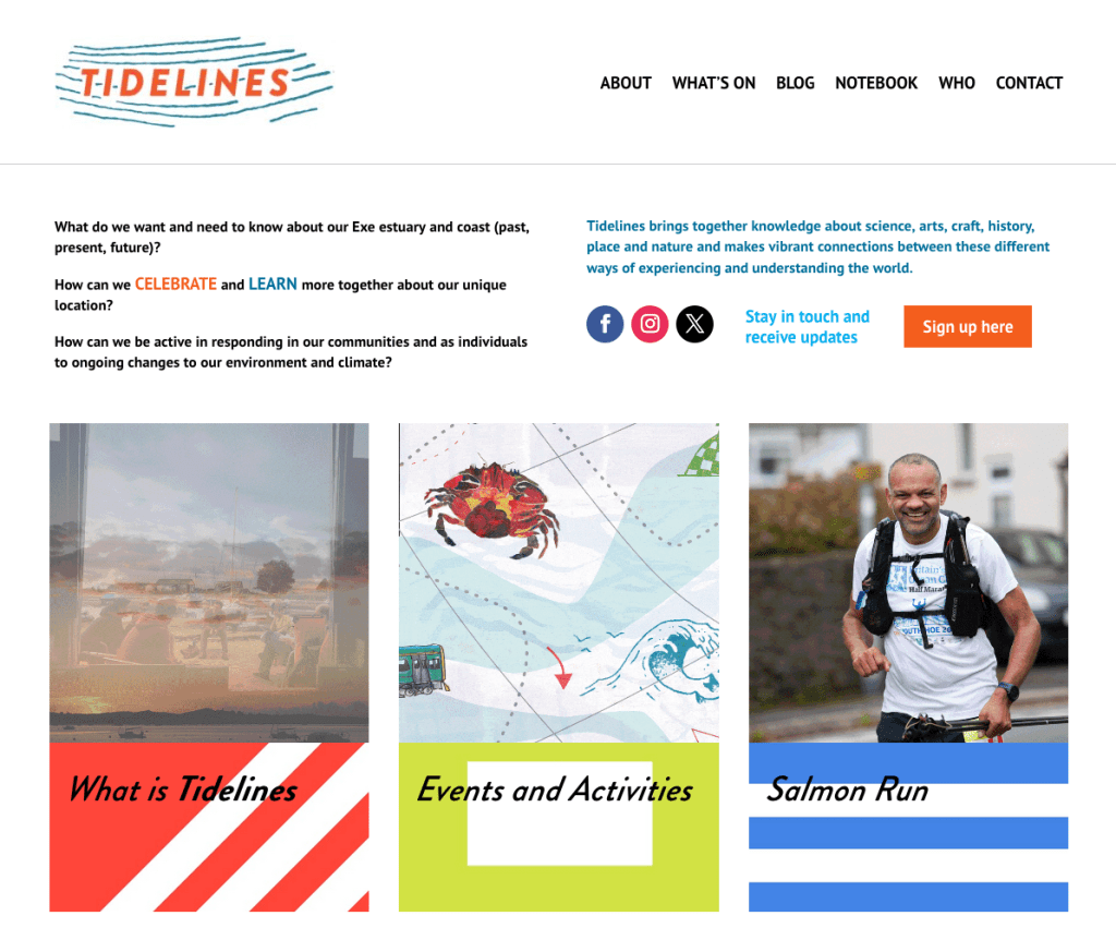
Click on image to go to the TIDELINES website. If it woon’t open on Google try Firefox browser.
Here is a screen grab.
Thnaks to all who visit!
This looks very exciting for those intertested in tides!
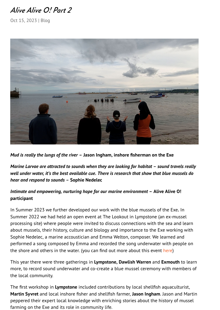
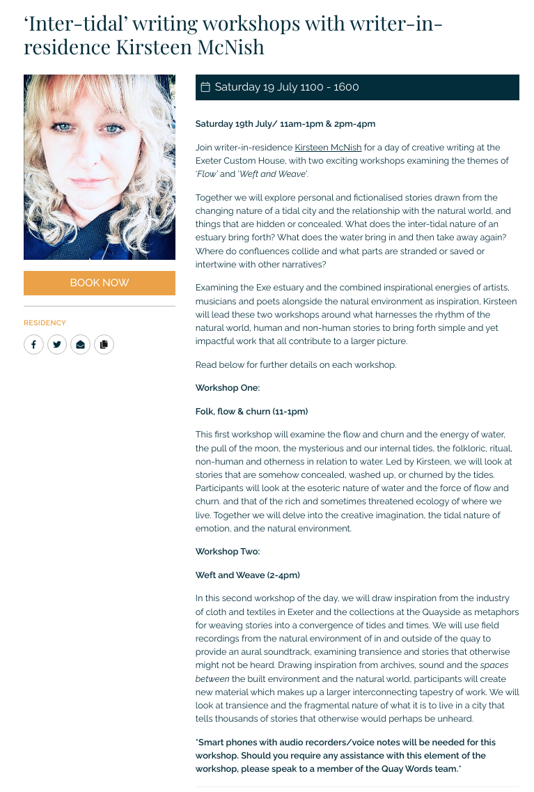
I have booked to go. Screen grab below.
Click here to jump to the page
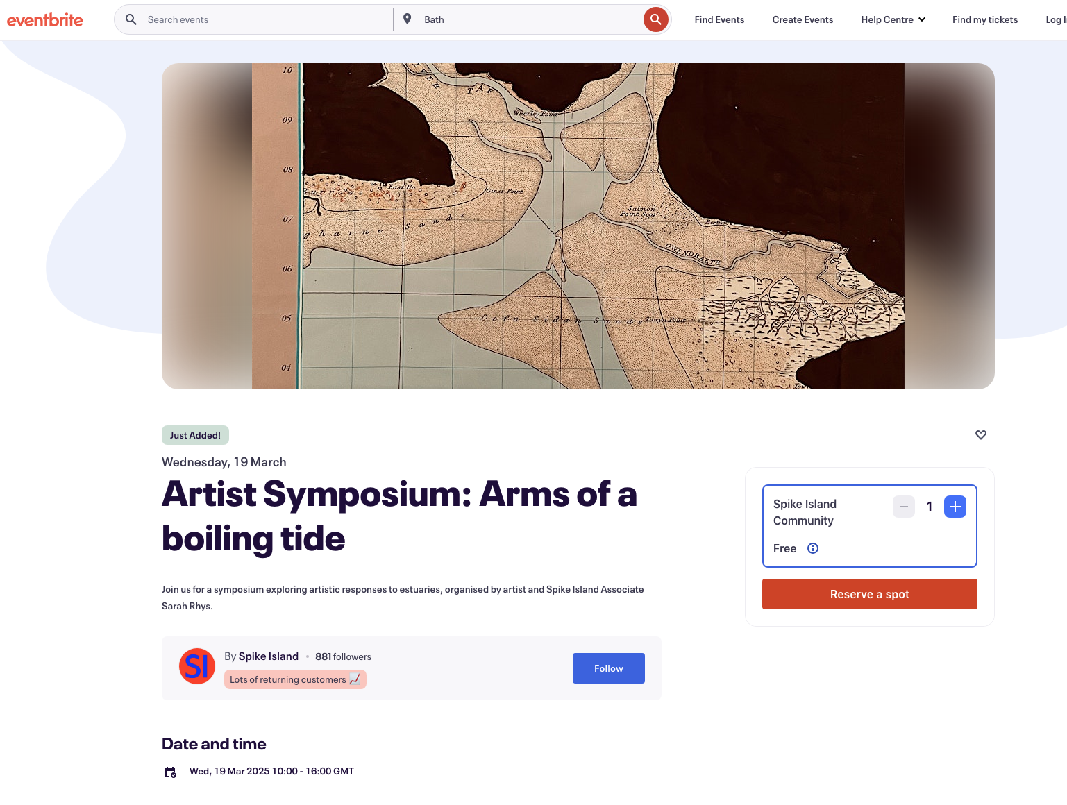
I will be speaking at this event. Tickets and more info here.
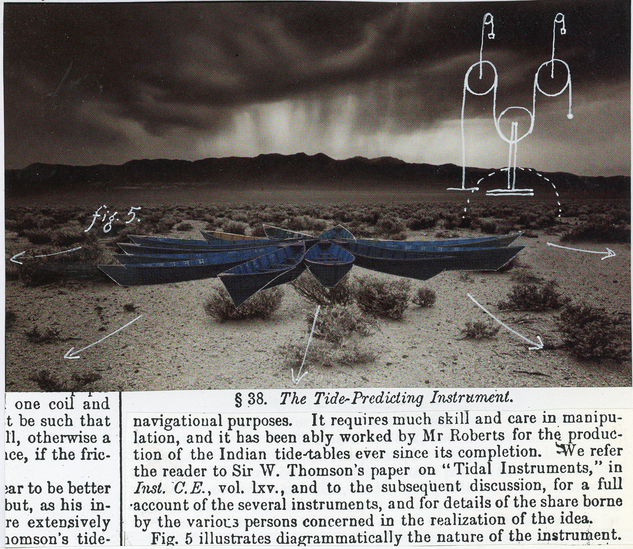
Heather Green kindly shared this with me. She made it for friends about a decade agao she says.
I an so plesed that Heather and I are now working together on the Severn Estuary element of her Tidal Timespace project. See here for that.
See here
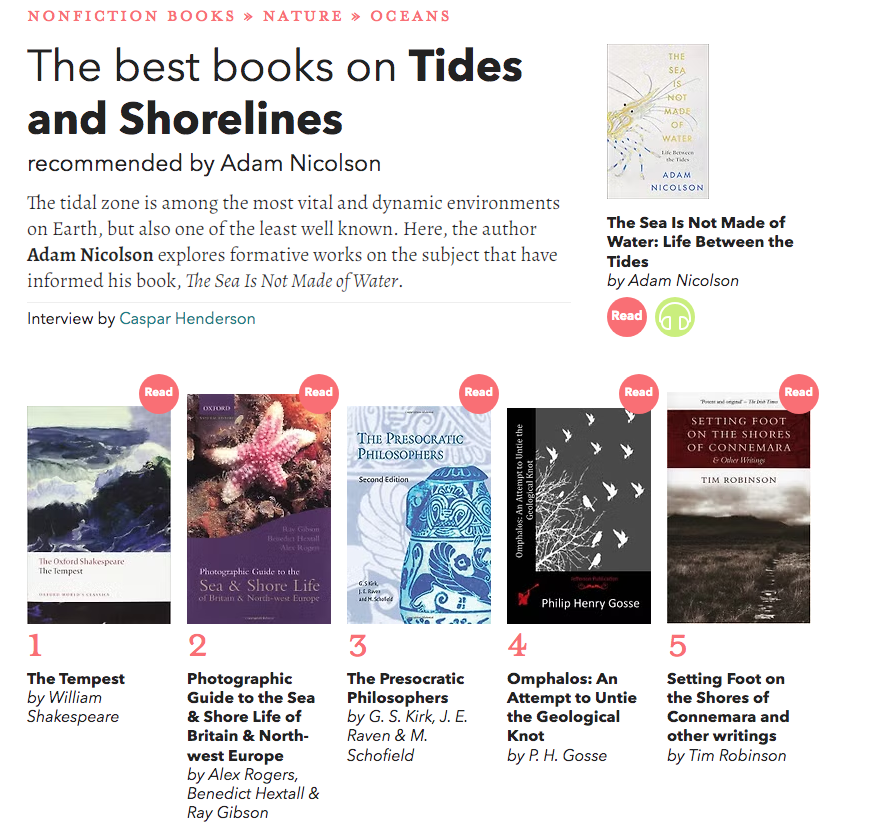
Click on the image below to jump to the page, which includes a discussion of each book, and of Nicholson’s books.
Click here to see a list of books about tides on this website.
The Rachel Carson Reserve is part of the The North Carolina Coastal Reserve & National Estuarine Research Reserve. The Reserve “is a network of 10 protected sites established for long-term research, education and stewardship. This program protects more than 44,000 acres of estuarine land and water, which provides essential habitat for wildlife; offers educational opportunities for students, teachers and the public, trainings for professionals; and serves as living laboratories for scientists.” Source here
The programme of activities includes bring teachers to explore and learn about the estuarine environments. Teachers on the Estuary (TOTE). See this video.
Of the Rachel Carson Reserve itself:
“The Rachel Carson Reserve is located between the mouths of the Newport and North Rivers and directly across Taylor’s Creek from the historic town of Beaufort in Carteret County. The main part of the site, just south of Beaufort, is a complex of islands which includes Carrot Island, Town Marsh, Bird Shoal, and Horse Island. These islands are more than three miles long and less than a mile wide. Middle Marsh, separated from the rest of the site by the North River Channel, is almost two miles long and less than a mile wide. The entire Rachel Carson component is 2,315 acres. Acquisition of the area was completed in 1985, with the addition of Middle Marsh in 1989. This site is also a Dedicated Nature Preserve, authorized by G.S. 143B-135.250.
The islands and estuarine waters of the Rachel Carson Reserve are strongly influenced by river and inlet dynamics and the twice-daily tides. The resulting mix of fresh and salt water creates a pristine estuarine environment where juvenile fish and invertebrates find shelter and food. Diverse arrays of important coastal habitats are found at the site including: tidal flats, salt marshes, ocean beach, soft bottom, shell bottom, dredge spoil areas, sand dunes, shrub thicket, submerged aquatic vegetation, and maritime forest.
More than 200 species of birds have been observed at the site, which is located within the Atlantic Migratory Flyway. Many species are considered rare or decreasing in number. The site is an important feeding area for Wilson’s plovers in the summer and piping plovers in the winter. The shrub thicket of Middle Marsh supports an egret and heron rookery. A diverse array of mammals inhabits the island including river otter, gray fox, marsh rabbit, raccoon, and a herd of feral horses. Atlantic bottlenose dolphins, diamondback terrapins, sea turtles, and many species of fish and invertebrates are found in the estuarine waters surrounding the site.” Source here.
To see the location on Google Earth click on below map.

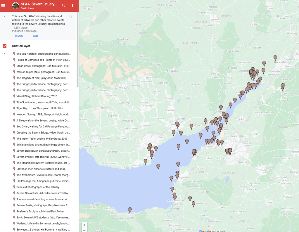
On a sister blog to this site is a list of about 100 artworks associated with the Severn Estuary (UK). It is an amazing and inspiring landscape, so it is no suprise that there is so much art associated with it. The Severn Estuary Art Atlas (SEAA) consists of a blog with a page for each artwork; and a linked Google map. One can hope back and forth between the blog and the map.
Click on the image below to jump to the blog

Click on the image below to jump to the map